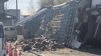
Continuing on the 地震 (earthquake) theme - this is Japan after all; one of the most tectonically active countries in the world. Last week the Japanese Government issued a fairly comprehensive report predicting the likelihood of major earthquakes occurring in the next 30 years. Now, some of this is geological tea-leaf reading, but a fair chunk of it is based on science and statistics.
It doesn't make for very reassuring reading either. Basically if you live on the Pacific coast south of Tokyo you are rolling the dice. And for every day that ticks by, the odds get shorter. Depending on the projected size of the earthquake, the potential number of fatalities quickly climbs into the hundreds of thousands.
Mind you, it's not much better up here in Hokkaido. To the east and southeast of the island lie two major fault lines, respectively the Kuril trench and the Japan trench. Here's a helpful map.
On the map, the two trenches are named in yellow on the top left, with the actual trenches the purple and orange (russet?) patches on the Pacific ocean side of Hokkaido and Tohoku.
Okay, the next diagram is a little trickier to explain, but thankfully you have RTE's very own earthquake expert on hand to to do so.
Yes, I know, lots of numbers and some of that indecipherable kanji writing. But let me take you by the hand ...
'M' is Magnitude. So, yes, you've guessed it, M7~8 refers to a magnitude 7 to 8 earthquake. The roman numerals indicate the possibility of an earthquake occurring in the next thirty years. A 'I' represents a less than 3% chance, whereas a 'III' means there's more than a 26% chance of something big rumbling our way.
'X' is where scientists think Godzilla will most likely appear.
So looking at the above map you can see that all down the Pacific Ocean side of Hokkaido we have an unhealthy mix of IIs and IIIs. A lot of IIIs in fact. All representing odds of 4 to 1 (or less) of a magnitude 8 earthquake occurring before my eightieth birthday.
Finally, we come to this equally cheerful graphic showing the potential maximum height of a tsunami should said magnitude 8 earthquake happen. Muroran is estimated to receive a tsunami with a maximum wave height of 9.4 meters. That's higher than your house. Hiroo-cho (広尾町) where I used to live (and where my heart lives still), is expected to be hit by a tsunami 25.4 meters high.
Twenty five point four freaking meters! In Dublin you would want to be living on the upper floors of the Capital Dock to avoid getting wet.
Thankfully, where we live in Muroran is forty-two meters above sea-level so we aren't too concerned (though I keep a surf board handy just in case). However, the elementary school where Sanae works is basically across the road from the sea. So, I am now making her wear a life jacket to work everyday. In Japan you can never be too prepared.


.PNG)


